
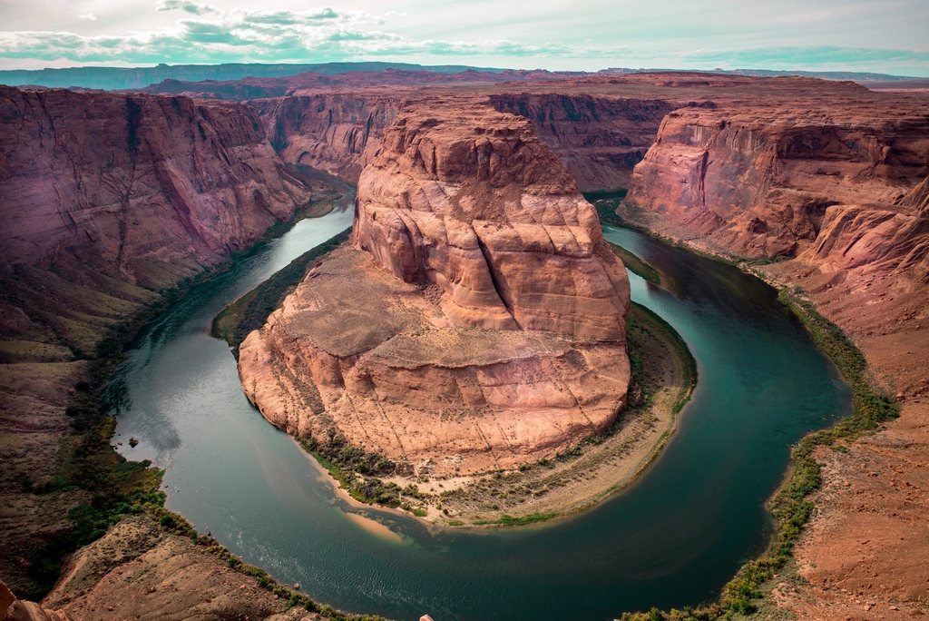
Big Bend is the park we recommend to people who think they have seen the American desert. It sits in the far southwest corner of Texas where the Rio Grande makes the sweeping turn that gives the place its name, and at 801,163 acres (324,000 ha) it is bigger than Rhode Island, emptier than almost anywhere in the lower 48, and a full day’s drive from any large city. Inside it, a single mountain range, the Chisos, rises like a green island out of the Chihuahuan Desert to almost 8,000 feet, and the river has sawn three canyons through the limestone mesas along the border. The South Rim walk and the short stroll into Santa Elena Canyon are the two edges of the park, and a first visit should include both.
The Chisos Basin: where the walk begins
The Chisos are the only mountain range in the United States contained entirely within a national park, and their heart is the Basin, a bowl at about 5,400 feet (1,650 m) ringed by cliffs and reached by a steep, winding road that is closed to long vehicles. The Basin has a campground and a small cluster of park facilities, though these have been the subject of a major redevelopment, so check what is open before counting on them. From the trailhead at the top of the Basin, three major trails fan out: the Window, which drops 900 feet (275 m) in 2.8 miles (4.5 km) to a notch in the cliffs where the whole Basin drains through a slot to the desert; the Laguna Meadow Trail; and the Pinnacles Trail. The last two are the two halves of the South Rim loop.
The South Rim: the finest view in Texas
The South Rim is not a summit but a cliff edge, the southern lip of the Chisos plateau, about 7,400 feet (2,255 m) high, where the mountains simply stop and the ground falls away 2,000 feet (610 m) to the desert floor. From the rim you look south across the Rio Grande, 20 miles away, into the mountains of Mexico, and on a clear winter day the view stretches past 100 miles. Nothing you have hiked to in the East prepares you for the scale of it.
The standard loop is 12.6 miles (20.3 km) with about 2,000 feet (610 m) of climbing, and the direction matters. Go up the Laguna Meadow Trail on the west side, a long, steady, shaded grade through pinyon and juniper to a high meadow, then continue on the Colima and South Rim trails to the edge. Return by way of Boot Canyon, a cool defile of oak, Arizona cypress and bigtooth maple with a spring that runs in wet years, and then down the Pinnacles Trail, which is steep and switchbacked and better descended than climbed. Add the Northeast Rim for a 14.5-mile (23.3 km) version with the best of the eastern views, but note that this stretch closes every year from February through May to protect nesting peregrine falcons. Fit walkers manage the loop in six to eight hours. Many prefer to carry a tent to one of the rim campsites, which are allocated by a backcountry permit reserved in advance, and watch the sunrise over the desert from the edge.
Emory Peak on the way
The highest point in the park, Emory Peak at 7,825 feet (2,385 m), is a 1-mile (1.6 km) spur off the Pinnacles Trail near the top of the pass. The spur gains about 700 feet (215 m), and the final 25 feet is a genuine rock scramble to a summit crowded with radio equipment and a view over the whole range. On its own, from the Basin, Emory is a 10.5-mile (16.9 km) round trip with 2,500 feet (760 m) of gain. Tacked onto the South Rim loop it pushes the day toward 15 miles, which in cool weather is a wonderful walk and in warm weather is a mistake.
Santa Elena Canyon: walking into the wall
Thirty miles (48 km) from the Basin by the Ross Maxwell Scenic Drive, the Rio Grande emerges from Santa Elena Canyon, a gash 1,500 feet (460 m) deep cut straight through the Mesa de Anguila. The left wall is Mexico, the right wall is Texas, and the gap between them is barely wider than the river. The Santa Elena Canyon Trail is just 1.7 miles (2.7 km) round trip: it crosses the mouth of Terlingua Creek, climbs a short set of stone switchbacks up the Texas bank, and then follows a shelf down into the canyon at water level until the cliff meets the river and the trail ends. It is the easiest great walk in the park, and the best time is late afternoon, when the low sun turns the west-facing walls gold.
Two cautions. Terlingua Creek is usually dry or a trickle, but after summer storms it can run deep with mud, and the park closes the trail when the crossing is unsafe. And the scenic drive is a full day in itself, with Sotol Vista, the Mule Ears viewpoint and the ruins of an old riverside farming settlement along the way, so plan the canyon for the afternoon and start the drive by noon.
- South Rim loop: 12.6 miles, 2,000 ft, up Laguna Meadow and down Pinnacles; 14.5 miles with the Northeast Rim.
- Emory Peak: 10.5 miles round trip from the Basin, or a 1-mile spur from the loop, scramble at the top.
- Santa Elena Canyon: 1.7 miles round trip, flat once past the switchbacks, best in late afternoon.
- Lost Mine Trail: 4.8 miles, 1,100 ft, the finest half-day in the Chisos, from the Basin road.
Heat, water and the calendar
The single rule of Big Bend is water. The park recommends a gallon (4 liters) per person per day, and on the South Rim loop we carry all of it, since the springs are unreliable and the trail has no shade for long stretches above the meadow. Summer temperatures along the river routinely pass 100 F (38 C), and even the Basin, ten to fifteen degrees cooler, is too hot for the loop by late morning from June to September. The hiking season runs from October to April. March, when spring breaks empty the Texas universities into the park, is the one time the Basin trailhead fills before dawn.
Winter can bring frost and occasional snow to the rim, and the day-night temperature swing is enormous all year. Black bears and mountain lions live in the Chisos, and the park asks that you keep children close and never leave food out. Cell coverage is essentially nonexistent, fuel is available at only two points inside the park, and the nearest hospital is more than 100 miles (160 km) away. That remoteness is the point. On the South Rim at sunrise, with the desert below turning from gray to rose to gold, you will understand why people drive so far to stand on an edge.