
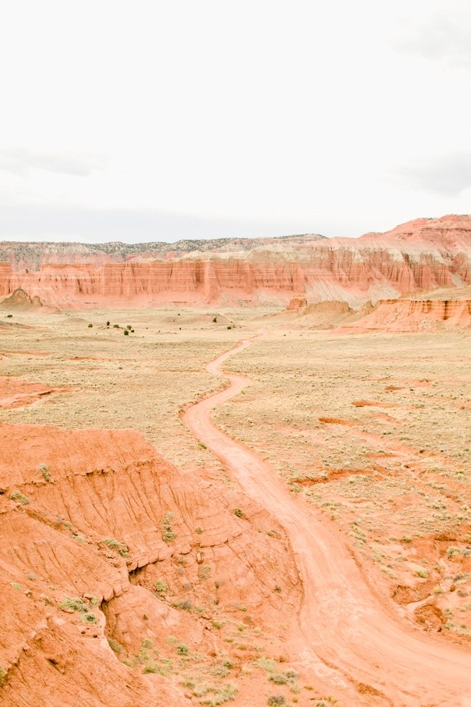
Capitol Reef is the park that people skip, and that is the best thing about it. Wedged between Bryce Canyon and Canyonlands on a highway that crosses southern Utah, it receives a fraction of the visitors of either, yet it protects a single geological feature that is bigger and stranger than anything in its neighbors: the Waterpocket Fold, a wrinkle in the crust of the earth nearly 100 miles (160 km) long. We have spent weeks here in every season, and it keeps giving up new canyons. This is a guide to understanding the fold and hiking the best of it, from the historic orchards on the river to the remote backcountry on its far side.
What the fold is
About 50 to 70 million years ago, the same mountain-building pressure that raised the Rockies buckled the flat-lying sedimentary layers of this region into a monocline, a one-sided step in the rock. The layers on the west side were lifted roughly 7,000 feet (2,100 m) higher than the same layers on the east, and the tilted rock between them, now eroded into cliffs, domes and slot canyons, is the reef. Early travelers called any barrier to wagon travel a reef, and the white Navajo sandstone domes reminded them of the Capitol in Washington. The water pockets are the countless eroded basins that hold rainwater for weeks and made the country crossable at all.
Fruita: orchards, petroglyphs and the scenic drive
The heart of the park is Fruita, a settlement founded by Mormon pioneers in the 1880s on the Fremont River at about 5,400 feet (1,650 m). The settlers are gone, but the park maintains their orchards, nearly 2,000 trees of cherries, apricots, peaches, pears and apples that you may pick in season for a small charge, eating as much as you like in the orchard for free. The historic schoolhouse, a blacksmith shop and a farmhouse store famous for its pies are all along the highway. A short boardwalk a mile east leads to a panel of petroglyphs carved by the Fremont people, who farmed this same river bottom between about 300 and 1300 A.D., with big-shouldered figures and bighorn sheep pecked into a cliff face. From Fruita, the paved Scenic Drive runs 7.9 miles (12.7 km) south along the base of the reef, with unpaved spurs into Grand Wash and Capitol Gorge.
The classic day hikes
The Hickman Bridge Trail, 1.8 miles (2.9 km) round trip with 400 feet (120 m) of gain, climbs from the river to a natural bridge with a span of 133 feet (41 m) and returns under it. It is the park’s most popular walk and best done early. The Cassidy Arch Trail leaves the Grand Wash road and gains 670 feet (204 m) in 1.7 miles (2.7 km) one way to a broad slickrock bench above a thick arch you can walk across; the view down Grand Wash from the top is the finest in the front country. Grand Wash itself is a flat walk of 2.2 miles (3.5 km) one way through the Narrows, where the walls rise 800 feet (240 m) and close to 16 feet (5 m) apart. Capitol Gorge, at the end of the Scenic Drive, leads in 1 mile (1.6 km) past a wall where pioneer travelers carved their names and dates, then up a short scramble to the Tanks, a chain of water pockets in the rock. For a big day, the Rim Overlook and Navajo Knobs Trail climbs from the Hickman Bridge trailhead to a viewpoint 1,000 feet (300 m) above Fruita and on to a summit knob at 9.4 miles (15.1 km) round trip with 1,620 feet (494 m) of gain.
The east side: Notom-Bullfrog Road and the Burr Trail
To see the fold as a fold, you have to leave the highway. The Notom-Bullfrog Road runs south along the east flank for about 60 miles (97 km), paved for the first few miles and then graded dirt that a normal car can manage in dry weather. Here the tilted layers stand up in ranks like the pages of a book on edge, and the road follows the strike valley between them. About 30 miles (48 km) down, the Burr Trail turns west and climbs the fold itself in a set of switchbacks that gain 800 feet (240 m) in half a mile, one of the great road views in the Southwest. Near the top, a rough spur leads to the Strike Valley Overlook, a short walk to a cliff edge with the entire fold laid out below like a geological diagram. From the same area, Upper Muley Twist Canyon offers a 9-mile (14.5 km) loop past several arches and along the very crest of the reef, and Lower Muley Twist, 15 miles (24 km) or more, is the backpacking classic, a canyon so twisted the pioneers said it would twist a mule.
Cathedral Valley
The northern third of the park is a different world of soft grey shale and freestanding monoliths of red Entrada sandstone. The Cathedral Valley loop is about 58 miles (93 km) of dirt road that begins with a ford of the Fremont River, requires high clearance and should not be attempted after rain. The reward is the Temple of the Sun and the Temple of the Moon, two isolated buttes 400 feet (120 m) high rising from a valley floor as bare as a Martian plain, and a field of gypsum sinkholes and glass-like selenite crystals nearby. Plan a full day, carry a spare tire and tell someone your route.
Seasons and logistics
- Best months: April to early June and September to October. Fruit harvest runs from cherries in June through apples in October.
- Summer: highs in the 90s F (32 to 37 C), and monsoon storms from July to September make every canyon and dirt road a flash-flood risk; the wash trails are exactly where you do not want to be in a thunderstorm.
- Winter: cold, quiet and often clear, with light snow on the domes; the Scenic Drive stays open, the dirt roads may not.
- Permits: the front country needs only the entrance fee for the Scenic Drive; overnight trips into Muley Twist or the northern district require a free backcountry permit from the visitor center.
Capitol Reef asks a little more of you than its neighbors, a dirt road, an early start, a map. In return it gives you the emptiest canyons in Utah and a lesson in how the earth bends.