
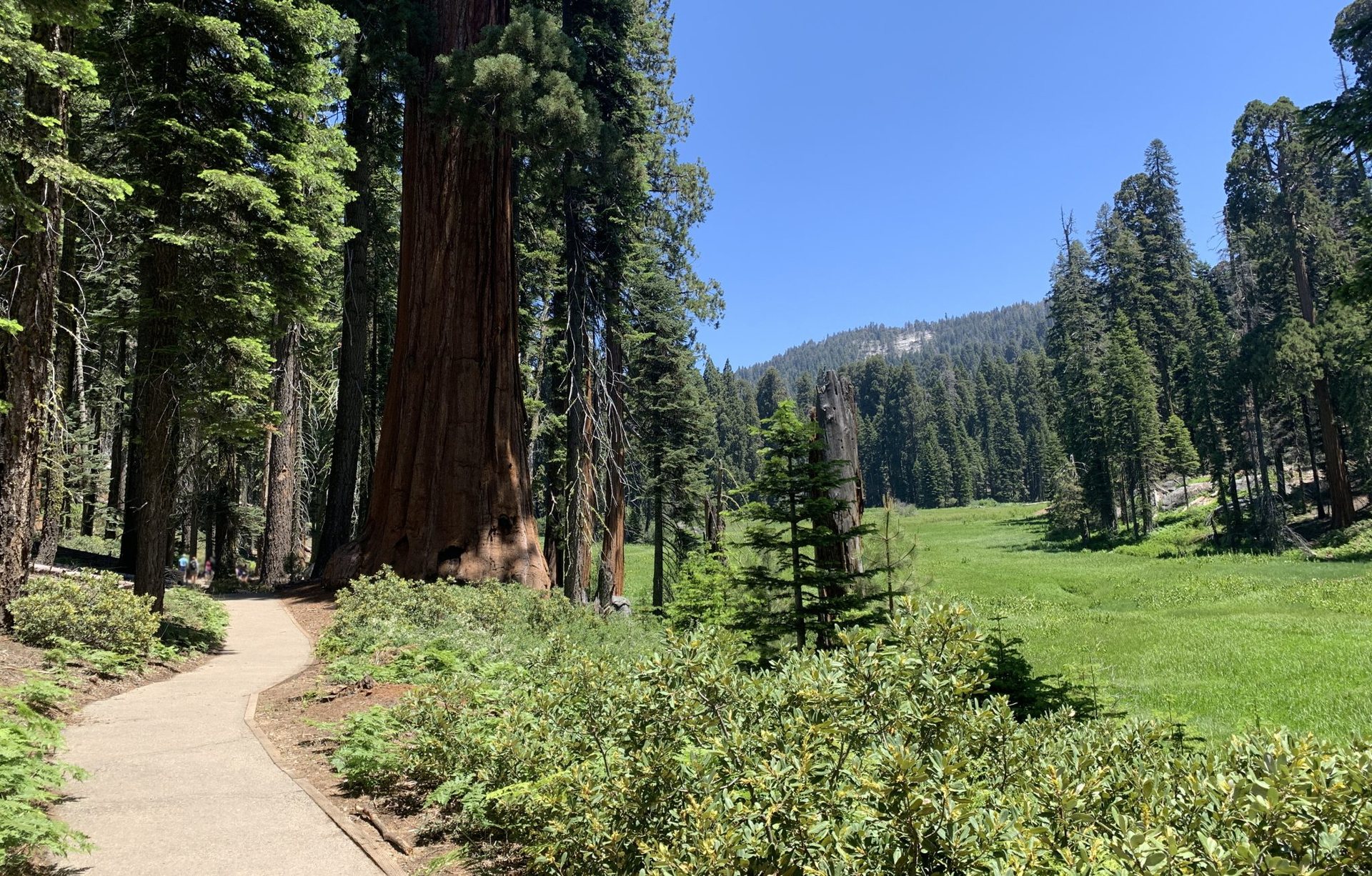
Sequoia and Kings Canyon are two national parks run as one, sharing a boundary, a road and a personality that is half cathedral, half wilderness. In the space of a single day you can climb a granite dome for a view of the Great Western Divide, stand under the largest tree on Earth and drive down into a canyon deeper than the Grand Canyon. Give the parks a week and you can walk the Rae Lakes Loop, one of the finest backpacking circuits in the Sierra Nevada.
Moro Rock: 350 steps to the Great Western Divide
Moro Rock is a granite dome that juts out of the western edge of the Giant Forest plateau like the prow of a ship, and the trail to its summit is one of the shortest big-payoff walks in the national parks. A stone staircase of roughly 350 steps, built in the 1930s and threaded through cracks and ledges with railings on the exposed sections, climbs about 300 feet (90 m) in a quarter mile (0.4 km) to the summit at 6,725 feet (2,050 m). The top is a narrow spine of rock with the Kaweah River canyon dropping 4,000 feet (1,220 m) on one side and the snow-streaked peaks of the Great Western Divide filling the horizon on the other.
Go early or late for the light and to avoid the queue on the stairs, which can be genuinely slow in mid-summer when the road to the rock is closed to private cars and served by a free shuttle. The stairs are closed in icy conditions and are no place to be in a thunderstorm; lightning has struck the rock more than once. Sunset from the summit, with the Divide turning pink, is one of the great moments in the parks.
The Giant Forest and the General Sherman Tree
The Giant Forest is the largest of the unlogged sequoia groves, more than 8,000 giant sequoias on a rolling plateau at around 6,500 feet (1,980 m), and it contains the General Sherman Tree, the largest living tree on the planet by volume. It stands about 275 feet (84 m) tall, measures 36 feet (11 m) across at the base and holds roughly 52,500 cubic feet (1,487 cubic meters) of wood; it is thought to be around 2,200 years old. A half-mile (0.8 km) paved path drops 200 feet (60 m) from the main parking area to the tree, and the walk back up is steeper than it looks at this elevation.
The best way to feel the forest, rather than just see its biggest resident, is to keep walking. The Congress Trail, a 2-mile (3.2 km) paved loop from the Sherman Tree, passes the President, the Senate and the House groups, tight clusters of monarchs that are more moving than any single tree. The Big Trees Trail, a flat 1.2-mile (1.9 km) loop around Round Meadow, shows why sequoias grow where they do: they need the meadow’s water and the fire that clears their competitors. From Crescent Meadow, at the end of the road, easy paths lead to Tharp’s Log, a fallen sequoia that a nineteenth-century rancher turned into a cabin, and to the start of the High Sierra Trail, which runs 72 miles (116 km) across the range to Mount Whitney.
Down into Kings Canyon
North of the Giant Forest, the Kings Canyon Scenic Byway leaves Grant Grove, home to the General Grant Tree, the second-largest sequoia and the nation’s official Christmas tree, and drops more than 3,000 feet (900 m) in a series of sweeping switchbacks to the floor of Kings Canyon. Measured from the summit of Spanish Mountain to the river, the canyon is over 8,000 feet (2,400 m) deep. The road ends, literally, at a place called Road’s End, at 5,035 feet (1,535 m), and it usually opens in late April or May and closes with the first serious snow in November. Zumwalt Meadow, a 1.5-mile (2.4 km) loop beside the river under the granite walls of the Grand Sentinel, is the perfect leg-stretcher, and the 8-mile (13 km) round trip to Mist Falls, a broad 45-foot (14 m) cascade on the South Fork of the Kings, is the best day hike from the trailhead.
The Rae Lakes Loop
Road’s End is also the start of the Rae Lakes Loop, a 41-mile (66 km) circuit with roughly 7,000 feet (2,130 m) of climbing that most parties walk in four or five days. It is popular for good reason: it packs a river gorge, a hanging valley, a high pass and a chain of alpine lakes into a route with no shuttle and no logistics beyond a permit. Going counterclockwise, the trail climbs past Mist Falls into Paradise Valley, a flat, forested shelf on the South Fork with three designated camps, then follows Woods Creek to a swaying suspension bridge and a long ascent into the high country. The Rae Lakes themselves sit at about 10,500 feet (3,200 m), a string of blue basins under the sharp tooth of Fin Dome and the red and cream stripes of the Painted Lady, and camping there is limited to two nights.
The high point is Glen Pass at 11,978 feet (3,651 m), a steep, rocky climb of about 1,500 feet (460 m) from the lakes with a final set of switchbacks that can hold snow into July. From the pass, the trail descends past Charlotte Lake and Vidette Meadow into the Bubbs Creek canyon, then runs 13 miles (21 km) downhill back to Road’s End.
Permits, bears and timing
Wilderness permits for the loop are strictly limited by daily quota at each trailhead, and the two entry points, Bubbs Creek and Paradise Valley, sell out months ahead for summer weekends; a reservation system opens in advance, with a small share held for walk-ups. Approved bear-resistant food canisters are mandatory throughout, and the Sierra black bears here are experts at everything else. The loop is normally snow-free from mid-July into early October, with mosquitoes worst in July and the best weather and quietest trails in September.
- Moro Rock: 0.5 miles (0.8 km) round trip, 300 feet (90 m) of gain, 30 to 45 minutes; closed in ice.
- Congress Trail from the Sherman Tree: about 2.7 miles (4.3 km) with the access path, 1.5 hours.
- Mist Falls: 8 miles (13 km) round trip, 800 feet (240 m) of gain, 4 to 5 hours; hot in the afternoon, start early.
- Rae Lakes Loop: 41 miles (66 km), 7,000 feet (2,130 m) of gain, 4 to 5 days; permit and bear canister required.
From the foot of the General Sherman Tree to the top of Glen Pass is a difference of a mile in elevation and a whole change in world, and it is all inside one park boundary. That range, from the biggest living things to the high, bare Sierra, is what makes these two parks feel like a lifetime’s worth of hiking.