
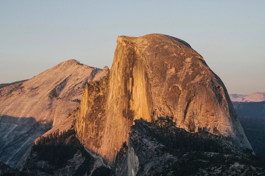
If one trail explains why people fall in love with Yosemite, it is the Mist Trail. In under three miles it climbs past two of the most powerful waterfalls in the Sierra Nevada, soaks you to the skin in spring, and hands you a view of Half Dome and Liberty Cap that postcards fail to capture. It is also the first leg of the most famous day hike in the National Park System: the cable route up Half Dome.
Starting at Happy Isles
The trailhead sits at Happy Isles, at the eastern end of Yosemite Valley, roughly 4,000 feet (1,220 m) above sea level. Private cars cannot park at the trailhead, so almost everyone arrives on the free valley shuttle or on foot from Curry Village, which adds about a mile each way. The first 0.8 miles (1.3 km) to the Vernal Fall footbridge follow a paved but surprisingly steep path along the Merced River, gaining about 400 feet (120 m). This is the busiest stretch of trail in the park; by mid-morning in summer it feels like a city sidewalk. Start before 7 a.m. and you will have the river and the cool air largely to yourself.
The footbridge is the first reward: a straight-on view of Vernal Fall dropping 317 feet (97 m) over a clean granite lip. The real Mist Trail begins on the far side of the bridge.
The granite staircase to Vernal Fall
Beyond the bridge the trail splits. The John Muir Trail heads right on a gentler grade; the Mist Trail goes left, hugging the river, and soon becomes a staircase of roughly 600 granite steps cut into the cliff beside the fall. From April to early July, when the Merced runs high with snowmelt, the spray drenches the entire staircase. Bring a rain shell, keep phones in a dry bag, and go slowly: the steps are polished, uneven and slick, and this is where most of the trail’s injuries happen.
The top of Vernal Fall, 1.5 miles (2.4 km) from the trailhead and about 1,000 feet (300 m) higher, is a wide granite bench with railings along the brink. Just upstream lie the Emerald Pool and the Silver Apron, a smooth slide of water over bare rock. Both look inviting on a hot day. Neither is safe for swimming: the current feeds directly into the fall, and people have been swept over the edge. Stay behind the rails.
On to Nevada Fall
The trail crosses the river on a second footbridge and climbs switchbacks below Liberty Cap to the top of Nevada Fall. This is the harder half. Trailhead to the top of Nevada Fall is about 2.7 miles (4.3 km) with roughly 1,900 feet (580 m) of gain, and the final pitch is rocky and exposed to the afternoon sun. Nevada Fall is taller than Vernal at 594 feet (181 m), and it does not spill over a lip so much as explode off it, fanning across a curved apron of granite.
Most day hikers return via the John Muir Trail, which descends along the cliff face with a spectacular, less crowded view of Nevada Fall, Liberty Cap and the back of Half Dome. The loop, Mist Trail up and John Muir Trail down, runs 6 to 7 miles (10 to 11 km) and takes most people five to seven hours. In winter and early spring the Mist Trail above the footbridge and the John Muir Trail below Clark Point close for ice; check the current status before setting out.
Little Yosemite Valley and Sub Dome
For Half Dome hikers, Nevada Fall is only the warm-up. The trail flattens through Little Yosemite Valley, a sandy, forested basin with a backpackers’ campground, then climbs through pine and fir for another two miles to the base of Sub Dome. The whole route from Happy Isles to the summit is 14 to 16 miles (23 to 26 km) round trip with about 4,800 feet (1,460 m) of gain, and a fit hiker needs 10 to 12 hours. Carry three to four liters of water per person; the last source is the Merced in Little Yosemite Valley, and it must be treated.
Sub Dome is the first real test of nerve: a staircase of tall, worn granite steps zigzagging up a steep shoulder with exposure on both sides. Many people who turn back on Half Dome turn back here, not on the cables. If Sub Dome feels like too much, listen to that instinct.
The cables
The cables rise about 400 feet (120 m) up the northeast face at an angle that reaches roughly 45 degrees. Two steel cables run parallel on posts set into the rock, with wooden boards laid across at intervals, so you climb hand over hand and rest on the boards. Gloves with a good grip are essential, and shoes with sticky rubber matter more than boots.
The cables are typically up from around Memorial Day weekend to early or mid-October, conditions permitting; when they are down, the route is closed. The most important rule is weather: never step onto the cables if clouds are building, if there is any sign of thunder, or if the rock is wet. Lightning has killed people on this summit, and smooth granite becomes a slide when damp. The summit, 8,836 feet (2,693 m) above sea level, is a broad field of granite with the Valley 4,800 feet directly below the famous visor. Give yourself thirty minutes, then descend facing the rock, which most people find easier and safer.
Permits, timing and what to carry
Half Dome requires a permit every day the cables are up, and demand far exceeds supply. The park runs a preseason lottery in early spring and a small daily lottery for remaining spots a couple of days before each date; backpackers can request Half Dome as part of a wilderness permit. Rangers check permits below Sub Dome. The Mist Trail to Vernal and Nevada Falls needs no permit at all, only the park entrance fee and whatever peak-season vehicle reservation system is in force.
- Best window for the falls: late April to June, when the Merced is at full flood.
- Best window for Half Dome: late June to September, once the cables are up and the trail is dry.
- Start time: on the trail by 5 or 6 a.m. for Half Dome, to be off the cables before afternoon storms.
- Essentials: 3 to 4 liters of water, grippy gloves, headlamp, sun protection, salty snacks, rain shell for the spray.
- Turnaround rule: if the weather changes or Sub Dome feels wrong, go down. Nevada Fall is a great summit of its own.
Whether you stop at the Vernal footbridge or stand on top of Half Dome, the Mist Trail delivers the Yosemite you came for: loud water, bright granite and the sense of being very small in a very large place.