
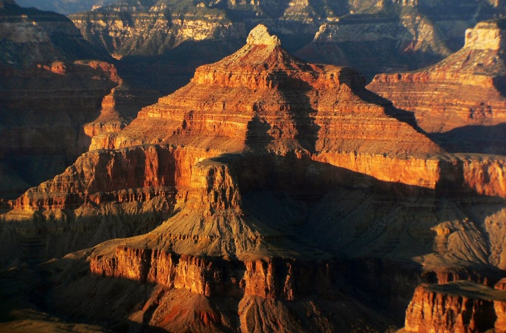
Every hiker who stands at the South Rim of the Grand Canyon feels the same pull. The river is right there, a green thread 4,500 feet (1,370 m) below, and the trail that leads to it starts a few steps from the parking lot. The problem is that the canyon is an upside-down mountain. You do the easy half first, downhill and fresh, and the hard half last, uphill, dehydrated and in the heat. We have hiked both of the South Rim’s corridor trails many times, and we want to explain how they work, how they differ, and why the park’s advice against day-hiking to the river and back is not an overcautious slogan but a lesson written in rescue statistics.
Two trails, one canyon
The South Rim has two maintained corridor trails to the Colorado River. The Bright Angel Trail leaves from the historic village at about 6,860 feet (2,090 m) and reaches the river in 7.8 miles (12.6 km), then continues another 1.7 miles (2.7 km) along the river and across a suspension bridge to the campground on Bright Angel Creek, for roughly 9.5 miles (15.3 km) total. It follows a natural fault line, which is why it has shade in the morning, a creek and a lush oasis at Havasupai Gardens about 4.5 miles (7.2 km) down, and seasonal drinking water at the resthouses at 1.5 and 3 miles (2.4 and 4.8 km).
The South Kaibab Trail begins at Yaki Point, about 7,260 feet (2,213 m), and drops to the river in roughly 7 miles (11.3 km) by following a ridge rather than a drainage. That means panoramic views almost the entire way, and it also means no water, almost no shade and a steeper grade. The classic overnight itinerary uses both: down South Kaibab for the views, up Bright Angel for the water and shade.
The South Kaibab, step by step
The first landmark is Ooh Aah Point, 0.9 miles (1.4 km) down and a fine turnaround for a short outing. Cedar Ridge at 1.5 miles (2.4 km) has a toilet and a broad flat where the canyon opens up in every direction; the park recommends this as the day-hike limit in summer. Skeleton Point at 3 miles (4.8 km) gives the first view of the river, 1,500 feet (460 m) further down, and this is where most day hikers should turn around no matter the season. Below it the trail switchbacks through the Redwall limestone to the Tipoff at 4.4 miles (7.1 km), then plunges through the dark Vishnu schist to the black suspension bridge and the river. From rim to river you lose about 4,780 feet (1,457 m).
The Bright Angel, step by step
Bright Angel starts with tight switchbacks through the Kaibab and Coconino cliffs, passes two rock tunnels and reaches the 1.5-Mile Resthouse after a descent of about 1,100 feet (335 m). The 3-Mile Resthouse sits at the top of the Redwall, and below it Jacobs Ladder drops steeply to Havasupai Gardens, a cottonwood-shaded campground and ranger station 3,060 feet (933 m) below the rim. From there a flat side trip of 1.5 miles (2.4 km) leads to Plateau Point, a cliff edge directly above the river that is one of the best day-hike destinations in the park. The main trail continues down the Devils Corkscrew, follows Pipe Creek to the river and turns upstream to the campground. The water pipeline that serves the resthouses has been under reconstruction in recent years, so parts of this trail have been closed at times; check current conditions before you plan around it.
Why rim to river and back in a day is a bad idea
The numbers are the whole argument. A round trip on Bright Angel to the campground is about 19 miles (30 km) with 4,380 feet (1,335 m) of descent and the same again in ascent. South Kaibab is shorter but steeper, and it has no water at all. The inner canyon in summer is routinely 20 to 30 degrees Fahrenheit hotter than the rim; temperatures above 110 F (43 C) are normal in the shade at the river in July, and the trail below Skeleton Point is in direct sun for most of the day. Hikers who feel fine at the river at 11 a.m. then have to climb the equivalent of a mile-high mountain through the hottest hours.
The park runs hundreds of search-and-rescue operations every year, and a large share of them involve fit, experienced day hikers who went too far down. Heat exhaustion, heat stroke and hyponatremia, which comes from drinking plenty of water while eating too little salt, are the usual diagnoses. A strong trail runner can do it in cool weather with careful planning, and people do. But the margin for error is thin, and the consequence of a mistake is not a bad day but an evacuation from a place where a helicopter may not fly in the afternoon wind.
How to do it right
The safe and far more rewarding version is to spend a night at the bottom. That means a backcountry permit for the campground on Bright Angel Creek, requested through the park’s advance lottery or the walk-up process, and both are competitive from spring through fall. Once you have that permit, the trip becomes two moderate days with a river swim in between. If you cannot get a permit, choose a hard day hike that turns around at Skeleton Point or Plateau Point and start before sunrise.
- Start at first light and plan to be climbing out of the hottest part of the canyon before 10 a.m., or to rest in shade between 10 a.m. and 4 p.m.
- Carry at least 3 liters of water per person on South Kaibab and eat salty food every hour; water without salt is how hyponatremia starts.
- Budget twice as long for the climb out as for the descent, and treat that as a hard rule.
- Wear real hiking shoes, a wide hat and sun sleeves; the Redwall reflects heat like an oven wall.
- Use the free shuttle to Yaki Point; private cars cannot park at the South Kaibab trailhead.
When to go
The best months for the corridor trails are March through mid-May and late September through November. Spring brings wildflowers along Havasupai Gardens and cool mornings; fall gives clear light and empty resthouses. Winter is quiet and often beautiful, but the top mile of both trails can be sheet ice, and traction devices are essential. Summer is the season of the fatal mistake, and if you must go then, hike only the upper sections and finish by mid-morning. The canyon has been there for six million years. It rewards patience far more than bravado, and the river tastes best when you have earned a night beside it.