
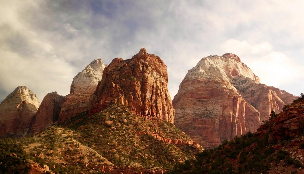
Zion Canyon is only about 15 miles (24 km) long, but it holds two of the most famous hikes in the entire national park system, and they could not be more different. One climbs a knife-edge fin of sandstone with chains bolted into the rock and a permit lottery guarding the last half mile. The other has no summit at all: you simply walk up a river between walls 1,000 feet (300 m) high until you feel like turning around. We have done both in every season, and this is how we would plan them today, from the shuttle stop to the last chain and the last cold wade.
Getting into the canyon at all
For most of the year, roughly March through late November and over the winter holidays, the Zion Canyon Scenic Drive is closed to private vehicles. You park at the visitor center near the south entrance, or in the gateway town just outside and take the town shuttle in, then ride the free park shuttle up the canyon. It stops at nine points; both hikes in this article start from it. The first buses leave around sunrise and the lines at the visitor center can be an hour long by 8 a.m. in spring and fall, so arriving early is not optional. In deep winter you can drive the road yourself, which changes the whole rhythm of a visit.
Angels Landing: what the permit actually covers
The trail to Angels Landing starts at the Grotto shuttle stop, crosses the Virgin River on a footbridge and climbs 2 miles (3.2 km) and about 1,000 feet (300 m) on a paved path through Refrigerator Canyon and up Walter’s Wiggles, a stack of 21 tight switchbacks built in the 1920s. That brings you to Scout Lookout, a broad sandy saddle with toilets and a view straight down into the canyon. Anyone can hike this far, and the view from Scout Lookout is worth the effort on its own.
The permit applies only to the final half mile (0.8 km) beyond Scout Lookout, where the route follows a narrow spine with sheer drops of more than 1,000 feet on both sides, protected by sections of chain. The total hike is 5.4 miles (8.7 km) round trip with 1,488 feet (453 m) of gain, and a fit hiker needs three to five hours including the queueing that happens where the chains are one-way. The park introduced permits in 2022 after years of dangerous crowding on the spine.
How the lottery works
There are two ways to get a permit and both are lotteries. The seasonal lottery opens for a window a few months ahead of each season; you pay a small application fee, list up to seven ranked dates and group sizes, and learn the result a few weeks later. The day-before lottery runs every day, opening in the morning and closing in the afternoon, with results that evening for hikes the next day. The odds vary a lot: a weekday in January is close to a sure thing, a Saturday in April or October is not. You must carry the permit, in print or on your phone, and rangers check it at Scout Lookout. Only one person in the group applies, so decide early who that will be and make sure the group size is right, because it cannot be changed afterwards.
A few practical notes. The chains section is not technical climbing, but it is exposed, and the sandstone gets slick when wet or icy; the park closes the spine when conditions are bad. Go early to avoid the afternoon heat on the west-facing wall. If anyone in your party is unsure at Scout Lookout, that is exactly the place to stop, and no permit obligates you to continue.
The Narrows from the bottom up: no permit, just a river
The Narrows is the section of Zion Canyon where the North Fork of the Virgin River fills the canyon wall to wall. From the Temple of Sinawava, the last shuttle stop, the paved Riverside Walk runs 1 mile (1.6 km) upstream to where the trail ends and the river begins. From there you are in the water. A bottom-up hike requires no permit as far as Big Spring, about 5 miles (8 km) from the shuttle stop with roughly 4 of them in the river, which makes for a full 10-mile (16 km) day if you go all the way. Most people turn around sooner. The junction with Orderville Canyon, about 1.5 miles (2.4 km) into the wade, marks the start of Wall Street, the narrowest and most photographed stretch, where the canyon is 20 feet (6 m) wide in places under walls that block the sky.
The top-down route, 16 miles (26 km) from a ranch outside the park, is a different undertaking that requires a wilderness permit and usually an overnight. The bottom-up version is the one for a normal park visit.
Water, gear and the flash-flood question
Progress in the Narrows is slow, perhaps 1 mile per hour, because the riverbed is a jumble of slippery cobbles and the water is anywhere from ankle to waist deep, with occasional short swims in the upper section during high flow. The water is cold even in August, and in spring and fall it is numbing. What works is a pair of closed-toe shoes with grip that can get soaked, neoprene socks, a sturdy walking stick and, outside high summer, a dry suit or dry pants. Keep your camera in a dry bag and assume you will fall at least once.
The river dictates the schedule. The park closes the Narrows whenever the flow exceeds 150 cubic feet per second, which happens through most of the spring snowmelt, often April into early June, and whenever a flash-flood warning is in effect. Summer monsoon storms from July through September can send a wall of muddy water down the canyon from rain that fell miles away under a blue sky. Check the daily flash-flood rating at the visitor center before you go, and if you see the water rise, turn brown or start carrying debris, climb to the highest ledge you can reach and wait. The best windows are late June and early July before the monsoon, and mid-September through October when the flow is low and the cottonwoods along the river are turning gold.