
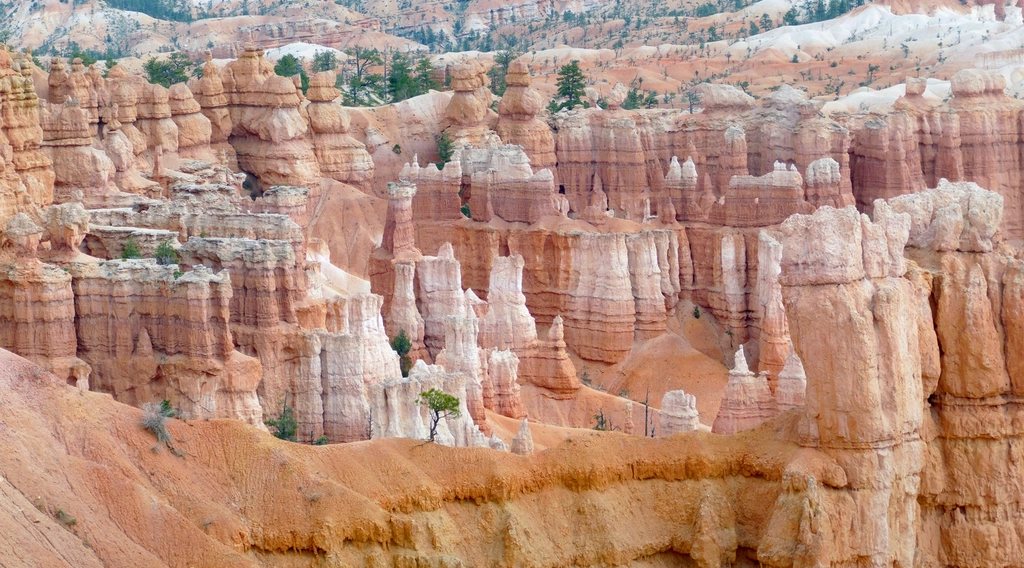
Bryce Canyon is the smallest of Utah’s big five national parks and, for a hiker, the easiest to fall in love with in a single morning. It is not really a canyon at all but a row of amphitheaters bitten out of the eastern edge of the Paunsaugunt Plateau, filled with thousands of limestone spires called hoodoos. The rim sits between 8,000 and 9,100 feet (2,440 and 2,775 m), so the air is thin, the light is sharp and the trails all go down first and up last. The combination of the Queens Garden Trail and the Navajo Loop is the walk that everyone should do, and we think it is one of the finest three miles in the whole park system.
What a hoodoo is and why Bryce has so many
The spires are carved from the Claron Formation, a soft pink limestone laid down in a lake about 50 million years ago. Water does the carving, but not as a river: frost does it. Bryce sees roughly 200 nights a year when the temperature crosses freezing, and each cycle pushes meltwater into cracks, freezes it, and pries the rock apart a little further. Harder caprock protects the softer stone beneath, so columns survive after the walls between them collapse. The result is a forest of stone in every shade from cream to deep orange, and it is changing fast in geological terms; the rim retreats two to four feet (0.6 to 1.2 m) every century.
The classic figure eight
The two trails link into a loop of about 2.9 miles (4.7 km) with roughly 600 feet (180 m) of elevation change, and most people take two to three hours with photographs. The park suggests, and we agree, that you should walk it clockwise: down the Queens Garden Trail from Sunrise Point, along the floor of the amphitheater, then up the Navajo Loop to Sunset Point. Queens Garden is the gentler grade, so you descend at a stroll, and the Navajo Loop’s steep switchbacks are easier to climb than to descend on loose gravel. Sunrise and Sunset Points are only half a mile (0.8 km) apart along the paved Rim Trail, which closes the loop.
Queens Garden: the descent
From Sunrise Point at about 8,000 feet the trail drops 320 feet (98 m) over 0.9 miles (1.4 km) to the Queens Garden itself. It is the least steep trail below the rim, which is why it is the recommended way down. The path threads through three short tunnels cut in the rock, crosses fins where the view opens onto the whole amphitheater, and ends at a spur to a hoodoo that, seen from the right angle, looks like a monarch in profile on a throne. Early morning is the time to be here: the low sun lights the spires from behind and the trail is nearly empty before 8 a.m.
Navajo Loop: Wall Street and Two Bridges
From the garden a connector trail follows a wash floor for about 0.8 miles (1.3 km) among ponderosa pines that seem out of place until you remember you are still above 7,500 feet. Then the Navajo Loop begins, and it splits. The Wall Street branch climbs a slot barely wide enough for two people, between walls hundreds of feet high, with a pair of tall Douglas firs growing out of the floor toward a sliver of sky. The Two Bridges branch climbs a parallel gully past two small natural bridges and the most famous hoodoo in the park, a slender column with a boulder balanced on top that looks like a hammer. Both branches meet at Sunset Point after 550 feet (168 m) of gain in 1.3 miles (2.1 km) if you did the full loop. Wall Street closes every winter, usually from late fall to spring, because of rockfall risk when the ice starts to melt, so in the cold months the loop becomes an out-and-back on the Two Bridges side.
Timing, altitude and weather
Bryce is a high place and many visitors arrive from sea level the same day. The loop is short, but the climb out at 8,000 feet can leave you gasping, so slow down and drink more than you think you need. Summer afternoons bring monsoon thunderstorms from July into September; the rim is the most lightning-prone spot in the park, and the rule is to be off it and heading to your car when the clouds build, typically by early afternoon. Spring and fall are the sweet spots, with cool mornings, clear skies and far fewer people. Winter is the secret season: snow on orange rock is astonishing, the Queens Garden Trail stays open, and traction spikes turn the icy switchbacks from frightening to fun.
- Sunrise Point at dawn, then straight down Queens Garden before the crowds arrive on the shuttle.
- Water, a hat and sunscreen even in winter: the sun is strong at this altitude and shade is scarce below the rim.
- Trail shoes with grip; the surface is fine gravel over hard clay and it rolls underfoot.
- Check the trail status board at the visitor center for Wall Street closures and for the shuttle schedule, which runs from spring to fall and is free but not mandatory.
If you want more
Hikers with energy left can add the Peekaboo Loop, which branches off the floor of the amphitheater and turns the day into a 6.4-mile (10.3 km) figure eight with about 1,500 feet (460 m) of total climbing, through the densest hoodoo country in the park. The Fairyland Loop from the north end, 8 miles (13 km) with fewer people and slightly less color, is the choice for a full day. And the Rim Trail between Bryce Point and Fairyland Point, 5.5 miles (8.9 km) one way, lets you see the whole amphitheater from above at any pace, with shuttle stops at the ends in season. But start with the classic figure eight. It is the walk that explains the park, and after it every other view at Bryce makes sense.