
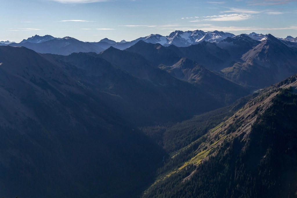
Paradise earned its name honestly. The subalpine meadows on the south flank of Mount Rainier, at about 5,400 feet (1,646 m), sit under a 14,410-foot (4,392 m) volcano draped in more glacial ice than any other peak in the contiguous United States, and for a few weeks every summer they turn into the most spectacular wildflower garden in the national parks. The Skyline Trail is the loop that ties it all together. We have hiked it in fog, in snow and in flower, and the timing of your visit will decide which of those three you get.
The loop in outline
The Skyline Trail is a 5.5-mile (8.9 km) loop that starts behind the visitor center at Paradise and gains about 1,700 feet (520 m) to a high point above 7,000 feet (2,130 m). Most people walk it counterclockwise, climbing the steeper western side first for a head-on view of the mountain, then descending the gentler eastern side past waterfalls and meadows. Allow four to five hours with stops, longer if you are photographing flowers, and start early: the Paradise parking lots fill by mid-morning on summer weekends, and in recent seasons a timed-entry reservation has been required to drive into the Paradise corridor during peak hours.
Climbing to Panorama Point
The first half mile is paved, and it is steep, following the Alta Vista knoll above the meadows. The pavement gives way to gravel and stone steps, and the mountain begins to dominate the view. At roughly 1.5 miles (2.4 km) a short spur reaches Glacier Vista, at about 6,300 feet (1,920 m), directly above the crevassed tongue of the Nisqually Glacier. This is the best place on the trail to understand what a glacier does: the ice cracks and groans in the afternoon heat, and the valley below is a raw trench of moraine and gray meltwater.
Steeper switchbacks then climb to Panorama Point at about 6,800 feet (2,070 m). The name is deserved. To the south, the Tatoosh Range rises like a saw blade, and on a clear day Mount Adams, Mount St. Helens and even Mount Hood in Oregon line up along the horizon. Above the point, the trail crosses a rocky shoulder that holds snow well into July, when the route is often rerouted along a signed high trail. Pikas call from the talus and hoary marmots sun themselves on the boulders; the mountain’s summit climbers are sometimes visible as a line of dots on the Muir Snowfield above.
Down the eastern side
From the high point the trail descends past the junction with the Golden Gate Trail, a shortcut that trims the loop to about 4 miles (6.4 km) by dropping straight through the flower slopes of Edith Creek basin. The full Skyline continues along the ridge with views into the Paradise River valley and Stevens Canyon before swinging down through the meadows. The last landmark is Myrtle Falls, half a mile (0.8 km) from the parking area, where Edith Creek drops 72 feet (22 m) into a small gorge with the mountain framed perfectly behind it. It is the most photographed spot in the park, and the reason is obvious the moment you arrive.
The wildflower calendar
Paradise receives more than 50 feet (15 m) of snow in an average winter, and the meadows do not melt out until late June or July. The flowers then run through a compressed sequence that repeats every year, shifting a week or two earlier or later depending on the snowpack.
- Late June to mid-July: avalanche lilies and glacier lilies push up within days of the snow retreating, along with western pasqueflower, whose mop-headed seed pods later become a trail favorite.
- Mid-July to early August: the main show begins with lupine, magenta paintbrush, bistort, valerian and arnica turning whole slopes purple, red and white.
- Late July to mid-August: peak bloom in most years, when every meadow on the Skyline is in flower at once and the air smells of lupine and warm fir.
- Late August to September: asters, gentians and pearly everlasting finish the season, and the huckleberry leaves begin to turn.
- Mid-September to early October: fall color, with the meadows glowing red and gold under the first dustings of new snow.
The park posts a weekly wildflower report through the summer, and it is worth checking before you drive up. If you can only choose one week, we would take the first week of August, accepting that we will share the trail with a great many people who had the same idea.
Protecting the meadows
The flowers exist on a knife edge. A subalpine meadow at this elevation has a growing season of six to eight weeks, and a single footstep off the trail can kill plants that took years to establish. Rangers here are unusually strict about it, and rightly so; the meadows at Paradise have been restored over decades after early visitors trampled them nearly bare. Stay on the trail and the rock steps, even when snow patches force a detour, and never step into the meadow for a better photo. The same goes for the marmots and deer, which have learned to beg and should not be fed.
Weather, snow and what to pack
Rainier makes its own weather. A blue morning at the trailhead can be whiteout fog at Panorama Point an hour later, and the mountain is often invisible for days at a time in early summer. Carry a shell, warm layers and a map, because the upper loop can be hard to follow when the snow lingers and the clouds drop. Sun protection matters more than people expect: the snowfields reflect ultraviolet light and the air at 7,000 feet is thin. Trekking poles help on the snow and on the long stone staircases, and traction devices are a good idea before mid-July. Water is available at the visitor center, but not reliably on the trail. In winter the road to Paradise is plowed and the loop becomes a snowshoe route, with the flowers sleeping under fifteen feet of snow and the mountain, when it shows itself, looking twice as big.
Whether you come for the ice, the flowers or the view of the whole Cascade Range lined up to the south, the Skyline Trail delivers in a single half day what many parks spread over a week. Pick your week on the calendar, and go.
Read next: Hiking in Tucson: Desert Trails, Waterfalls and Sky Island Peaks