
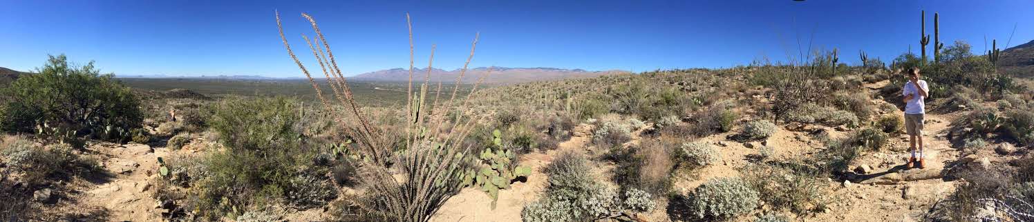
Hiking in Tucson means three kinds of walking in one city. You get saguaro forest trails in the Sonoran Desert, canyon hikes that end at waterfalls, and mountain climbs that leave the desert heat behind. Pick the type that fits your fitness and your season, then plan around water, shade and weather.
What makes hiking in Tucson different?
Tucson sits in the Sonoran Desert. Giant saguaro cacti, palo verde and ocotillo fill the landscape. Summer temperatures peak well above 100°F.
Four mountain ranges surround the city. They are the Catalinas, the Rincons, the Santa Ritas and the Tucson Mountains. Mt. Lemmon, the tallest peak in the area, rises over 9,000 feet.
This matters for your plan. A dusty desert trail can climb into canyons with water, or up to pine trees and wide views. The climate can change a lot along a single route.
Saguaro National Park borders the city on both the east and west sides. It is the easiest place to start if you only have a short window.
Which Tucson hikes are easy?
Short, mostly flat trails work well for a first day. They let you see the desert without a big commitment.
Valley View Overlook
This trail is less than a mile long. It crosses a wash and reaches an overlook above hundreds of saguaros. It sits in the west section of Saguaro National Park, called the Tucson Mountain District, along the Bajada Loop Drive.
Mica View Loop
This is another easy desert walk in Saguaro National Park. It is in the east section of the park.
Tumamoc Hill
This paved trail climbs steadily for 2.9 miles near “A” Mountain. It gives you views over the city and a look at desert wildlife. Check the access rules first. The trail is closed on weekdays during the day because of a University of Arizona research station. Pets are not allowed.
Note the park fee on the Saguaro trails. You can pay at entry or use a national park pass.
Where are the best waterfall hikes?
The desert is not always dry. Depending on the season and recent rain or snow, several canyons near Tucson carry running water.
Seven Falls
This is one of the best-known hikes in the area. It runs through Bear Canyon in Sabino Canyon Recreation Area and passes several creek crossings. Expect wet feet. The full route is about 8 miles round trip. The Sabino Canyon tram can shorten it by 2 miles each way. Go early or on a weekday, because it gets busy.
Tanque Verde Falls
The route is short but not easy. The path fades and you scramble over boulders along the creek. The main fall is tall and drops into a large pool. Flash floods are a real risk in the rainy season. Many people consider it one of the riskier hikes near Tucson, so use caution and skip it when storms are possible.
Romero Pools
This hike starts at the Romero Canyon Trailhead in Catalina State Park. The first mile is easy. The last 1.8 miles are steep and rocky. At the top you reach the pools and views of Mt. Lemmon, Oro Valley and Tucson.
Water flow changes from year to year. Check conditions before you drive out.
What are the harder climbs?
If you want a real effort, head for the mountains.
Finger Rock Trail
This 8.2 mile route is described as one of the hardest in Tucson. It gains about 4,000 feet of elevation. The trail is narrow and steep and includes some rock climbing. In return you get views of the Catalina Mountains and plant life that runs from saguaro to pine.
Mt. Wrightson
This is the high summit of the Santa Rita Mountains in southeastern Arizona. The summit sits at 9,450 feet. A well-graded route called the Old Baldy Trail starts at Madera Canyon, a well-known birding area. A guided group reached the top in less than four hours. About a mile below the summit is Baldy Saddle, a good rest stop with meadows and pines. The last stretch is steep and rocky, so go slowly.
On a clear day the views reach more than 60 miles into Mexico. Other sky island ranges are visible, including Baboquivari, Mt. Lemmon and the Rincons.
Mountain weather can turn fast. A fatal blizzard struck the mountain in 1958 even though the forecast called for pleasant conditions. Carry layers, start early and turn around if the sky changes. Monsoon storms are possible in summer afternoons.
How do you prepare for desert hiking near Tucson?
The desert gives you little water and little shade. Prepare for both.
- Carry more water than you think you need.
- Wear a hat and sunglasses, and use sunscreen.
- Bring a day pack for water and snacks.
- Wear shoes with good grip. For trails with many creek crossings, sandals that dry quickly can work.
- Start early in warm months.
Pick the trail for the season. Summer favors the high mountains, where the Santa Ritas offer a way out of the heat. Waterfall trails depend on recent rain and snow. Saguaro viewpoints work best in the cooler part of the day.
If you want help reading the terrain, local guided tours operate in the Tucson area. A guide can match a route to your fitness and explain the desert ecology.
Related reading
- Utah’s Big 5 National Parks: What They Are and How to Plan a Trip
- Three Olympic National Parks in One: Hurricane Ridge, the Hoh Rainforest and the Wild Coast
Sources
- Hiking in Tucson – 5 Awesome Adventures (southwestdiscoveries.com, accessed 2026-11-09)
- 11 Beautiful Tucson Hiking Trails (nomanbefore.com, accessed 2026-11-09)
- Take a hike: Five trails around Tucson – The Daily Wildcat (wildcat.arizona.edu, accessed 2026-11-09)
Photo: Sabino Canyon, Tucson, Arizona, United States 8, by Vagabondah, CC BY-SA 4.0 (Wikimedia Commons)